
****JavaScript web menu drop down DHTML menu generated by NavStudio. (OpenCube Inc. - http://www.opencube.com)****
|
|
Geographic Information Systems: What is GIS?"A geographic information system (GIS) is a computer-based tool for mapping and analyzing things that exist and events that happen on earth. GIS technology integrates common database operations such as query and statistical analysis with the unique visualization and geographic analysis benefits offered by maps." ESRI; www.gislounge.comGIS is a rapidly growing technological field that can assess real world problems, such as prioritizing sensitive species habitat or determining the effects of future development on the environment, through incorporating graphical features with tabular data. GIS is a tool to aid in decision making and provide an intuitive visual "explanation" of phenomenon. GIS is a computer-based data collection, input, storage, analysis, and cartographic visualization technology that integrates data from diverse sources into a geographic database. Typical data sources include existing maps, aerial photographs, satellite imagery, text files, statistical data, and in situ measurements (e.g. water quality monitoring in the field). What is now the GIS field began in 1960, with the discovery that maps could be programmed and stored in the computer allowing for necessary future changes. This technology replaced the era of hand cartography, where even small changes meant the map would have to be completely re-drawn. What Can GIS Do?
Real World Uses of GIS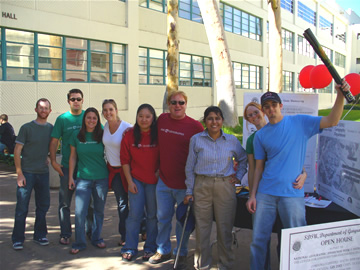 Given the capacity of a GIS to help in answering many types of questions, it is not surprising that it has become a powerful tool for decision makers in government agencies at all levels. A review of geospatial data created by jurisdictions in San Diego County highlights the potential for more than a hundred applications, including those of interest to water quality professionals as well as members of the public who wish to participate in watershed management. Given the capacity of a GIS to help in answering many types of questions, it is not surprising that it has become a powerful tool for decision makers in government agencies at all levels. A review of geospatial data created by jurisdictions in San Diego County highlights the potential for more than a hundred applications, including those of interest to water quality professionals as well as members of the public who wish to participate in watershed management.
Winning Team 1, at San Diego State University Geography Department's GPS Treasure Hunt Careers in GIS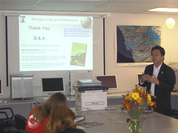 Those wishing to pursue careers in professions involving GIS applications need look no further than the universities and colleges in San Diego County , one of the core areas of GIS education and research in the United States . Foremost among the GIS programs in the local area are the geographic information science curricula offered by the Department of Geography at San Diego State University (http://geography.sdsu.edu/index.html ). Geospatial Job Information (from ESRI.com) Those wishing to pursue careers in professions involving GIS applications need look no further than the universities and colleges in San Diego County , one of the core areas of GIS education and research in the United States . Foremost among the GIS programs in the local area are the geographic information science curricula offered by the Department of Geography at San Diego State University (http://geography.sdsu.edu/index.html ). Geospatial Job Information (from ESRI.com)
Presentation at San Diego State University GIS Day by Dr. Ming Tsou GIS Careers typically include positions such as:• Cartographic designer • Computer programmer • Database administrator • Project manager • System administrator GIS jobs range from part-time posts in small towns to full-time posts in large cities, so the average salary varies widely. The salary range is typically between $31,387 for an entry level GIS analyst I to $83,333 for a GIS supervisor. |
|